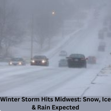
As the first month of 2025 rolls in, so does a potentially dangerous winter storm. This weekend, the Midwest will experience significant weather disruptions, as snow, ice, and heavy rain are expected to wreak havoc from the Plains to the Mid-Atlantic states. With the storm’s origins in the Pacific Ocean, it is rapidly gathering strength, bringing with it a mix of precipitation that will challenge travelers, disrupt daily life, and require communities to brace for the cold.
What’s Happening? A Winter Storm in Early 2025
While winter has been fairly quiet across much of the central United States, the weather pattern is about to shift dramatically. Most areas have experienced below-average snowfalls, but this weekend, that changes. A major storm system will be moving in from the Pacific and impacting the Midwest and Eastern U.S. by Sunday, with snow, ice, and rain expected to cause widespread disruption.
Storm’s Origins: How it Develops
The storm brewing in the Pacific Ocean is beginning to push eastward. By Saturday, it will make landfall in the Pacific Northwest, where it will begin to drop heavy mountain snow. As the system moves inland, it will draw in moisture, meeting up with cold air in the Midwest, resulting in the mixture of precipitation that will affect millions across the central U.S. and Mid-Atlantic.
The Path of the Storm: Midwest to Mid-Atlantic
On Sunday, the storm will make its way toward the central U.S., beginning with the Midwest. As it advances eastward, it will bring mixed precipitation, including snow, ice, and rain, into the Ohio Valley, Mid-South, and even the central Appalachians. The storm will continue to shift further east, affecting the Mid-Atlantic by Sunday night and Monday, potentially even reaching as far south as the Carolinas.
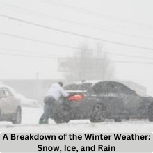
A Breakdown of the Winter Weather: Snow, Ice, and Rain
Let’s break down the different types of weather you can expect:
- Snow: Significant snowfall is expected across the northern Plains and Ohio Valley, with a possibility of “plowable” snow accumulations. Cities like Chicago and St. Louis could see several inches of snow.
- Freezing Rain: In areas like the lower Ohio Valley and parts of the Mid-South, freezing rain could lead to treacherous conditions. Power outages, downed trees, and hazardous driving conditions are all concerns.
- Rain: While snow will dominate the northern regions, rain will likely take over the south, especially in places like the Carolinas. The rain could turn to snow in some areas before tapering off by Monday.
Impact in the Midwest: What to Expect
The Midwest is likely to feel the brunt of the storm, with snow and ice making their way into cities like Kansas City, Indianapolis, and Chicago by Sunday. This could lead to significant travel disruptions, as roads and highways become slick with ice or snow. The FOX Forecast Center predicts that snow will accumulate in several cities, making it difficult to clear roads quickly. Ice accumulation could make it even worse, leading to dangerous conditions for drivers.
The Role of Cold and Warm Air: A Recipe for Chaos
What makes this storm particularly disruptive is the collision of cold and warm air masses. As the storm moves eastward, it will clash with a mass of warm air, resulting in a mix of precipitation types. This mixture will lead to snow, ice, and rain, all occurring within the same area, making travel dangerous and unpredictable. The rapid changes in temperature also increase the likelihood of icy patches forming on roads, even in places where snow is not expected.
Also read: Mardi Gras 2025: How to Grab Hubig’s New King Cakes
Areas Likely to Experience Freezing Rain and Ice
The lower Ohio Valley and Mid-South are at the highest risk for freezing rain. Cities such as Louisville, Cincinnati, and Nashville may experience ice accumulation, which can create hazardous conditions. Freezing rain is particularly dangerous because it can cause power outages and make driving nearly impossible. Drivers should avoid travel in these areas, especially as the ice builds up on trees, power lines, and roads.
The Mid-Atlantic: Storm Moves Eastward
By Sunday night into Monday, the storm will push eastward, reaching the Mid-Atlantic. This will bring snow, ice, and rain to major cities like Washington, D.C., Baltimore, and Philadelphia. While the storm may weaken slightly by this point, the impact will still be significant, especially for commuters who face slick roads and reduced visibility.
Thunderstorms in the Mix: Unusual Winter Weather
While it’s not common to see thunderstorms during winter storms, this system has the potential to bring a rare mix of heavy snow and lightning. Thunderstorms in winter, also known as “thundersnow,” are rare, but they can happen when powerful atmospheric forces combine. If this occurs, it could lead to localized heavy snowfalls, with rapid accumulation making it even harder to keep up with road clearing.
Timing and Duration of the Storm
The storm will start affecting the Midwest on Saturday evening and continue into Sunday. The heaviest precipitation will likely occur on Sunday, with the storm lingering into Monday. While the system is expected to weaken as it moves over the Appalachian Mountains, snow, ice, and rain will still cause disruptions as it travels eastward. The storm should taper off by Tuesday, but the damage and delays from the weekend will linger for days.
Monday: A Weaker Storm but Ongoing Winter Weather
By Monday, the storm is expected to weaken as it crosses the Appalachians. However, the mid-Atlantic and possibly parts of the Carolinas will still experience winter weather. Snow and ice may continue to affect areas further south, though the worst of the storm will have passed. That said, the lingering cold temperatures will keep roads hazardous for much of the East Coast.
How to Prepare for the Winter Storm
With a storm of this magnitude on the way, it’s essential to prepare. Here are some tips:
- For Drivers: If you can avoid traveling, do so. If you must drive, equip your vehicle with snow tires or chains, and always carry an emergency kit.
- For Homeowners: Ensure your home is ready for winter by checking insulation and weatherproofing doors and windows. If you live in an area that may experience power outages, stock up on essentials, including water, batteries, and non-perishable food.
Also read: Is Bitcoin’s $92K Drop the Beginning of a Bigger Crash?
Conclusion
In conclusion, the upcoming winter storm is set to bring significant disruptions across the Midwest and into the Mid-Atlantic. With snow, ice, and rain all in the forecast, travelers and residents need to stay informed and take precautions. While this storm may weaken by Monday, its impacts will still be felt long after it has passed.
FAQs
How much snow will the Midwest get?
Snow accumulations vary, but cities like Chicago and St. Louis could see several inches, possibly leading to difficult travel conditions.
When will the storm reach the East Coast?
The storm will affect the Mid-Atlantic by Sunday night into Monday, with snow, ice, and rain expected to impact cities like Washington D.C. and Philadelphia.
How can I prepare for the ice?
Ensure that your car is equipped for winter weather, keep extra blankets and non-perishable food at home, and avoid travel during the worst conditions.
Will the storm cause power outages?
Yes, the combination of ice and snow can bring down power lines, especially in areas like the lower Ohio Valley and Mid-South.
How long will the storm last?
The storm will start on Saturday evening, with the heaviest impacts occurring on Sunday. By Monday, the storm should weaken, but winter weather will continue to affect parts of the East Coast.

